Britain’s first totally scientific voyage in HMS Paramour had as its aim the investigation of variations in the compass (magnetic variations) in the South Atlantic ocean. It was under the command of Edmond Halley (of Halley’s comet fame) and in pursuit of his aims reached a far south point of 52° S where he met with pack ice in 1700. Though the voyage contributed to science it did not even reach as far as the island’s of South Georgia.
In 1720 Captain George Shelvocke, whose voyage was the basis of the poem, The Rime of the Ancient Mariner, sailed to 61° 30′ S. He was followed in 1739 by Jean-Baptiste Charles Bouvet de Lozier who discovered Bouvet Island (54°26′S 3°24′E)
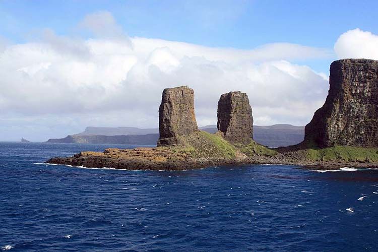
In 1771, the First French Antarctic Expedition was sent out under the command of Yves Joseph Kerguelen, a French naval officer. He sailed in search of what was believed to be ‘a very large continent’ in the south. He thought he had discovered the continent when he reached an island at 49°15′S 69°35′E that he originally called ‘South France’ but later changed this to the ‘Isle of Desolation’ in a later voyage when he realised that it was an island. This island was eventually named Kerguelen, after him.
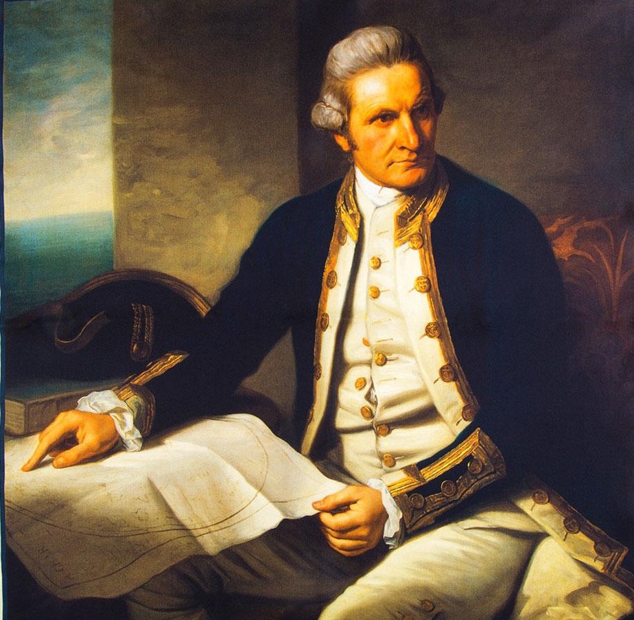
Although these early explorers had gradually pushed the boundaries of our knowledge of what lies to the world’s south, it was Captain James Cook‘s 2nd expedition south (1772-1775) in the two ships Resolution and Adventure which finally crossed the Antarctic circle and reached the furthest point south (71° 10′ S) of any voyage at that time.
Although Cook was only about 120 km (75 miles) from the Antarctic continent he did not sight Antarctica but surmised that a large land mass existed further south from the huge amount of icebergs that he encountered and the fact that some of them contained pieces of rock.
After Cook, further exploration of the Southern oceans entered a lull for the next 45 years or so, though sealers and whalers made the occasional new discovery. There was a resurgence of interest between 1819 and 1843.
Throughout the 1780s to 1839, American and British whalers and sealers made occasional discoveries as they searched for new resources. In 1819 the first land south of 60° was discovered by William Smith when he discovered the South Shetland Islands (62°00′S 058°00′W).
A Spanish ship, the San Telmo, was wrecked off Livingston Island in 1819 and sealers later found wreckage of the ship on the island, so it is possible that some of the crew survived, only to die of the cold. There is no definitive proof but they may have been the first people to die in Antarctica.
From 1819–1821 the Russians conducted a circumnavigation expedition of the world and in the process Fabian Gottlieb von Bellingshausen and Mikhail Lazarev, both Admirals in the Russian Imperial Navy, became the first explorers to see and officially discover the land of Antarctica, when they found what would later become known as the Fimbul Ice Shelf (69°21′28″S2°14′50″W) in 1820.
A few days later Edward Bransfield, an Irish sailor and Royal Navy officer sighted Trinity Peninsula, the northernmost point of the Antarctic mainland. That same year, the American sealer and explorer, Nathaniel Palmer sighted Antarctica (the Antarctic Peninsula again) on 17 November 1820. He would also later discover the South Orkney islands, along with British sealer, George Powell.
Although John Davis is sometimes credited with being the first to set foot on Antarctica in 1821 at Hughes Bay (64°13′S 61°20′W) it is more likely that it was some of his crew, though the individuals are un-named.
In 1823 the Weddell Sea was discovered by James Weddell in his ship Jane and he also reached the furthest point south at that time (74°15′S 30°12′W)
John Biscoe, an English sealer, circumnavigated the Antarctic continent on his Southern Ocean Expedition between 1830–1833. he would also step ashore on Anvers Island; named Graham Land; discovered the Biscoe and Queen Adelaide Islands; and sighted Enderby Land (67°30′S 53°0′E)
Jules Dumont d’Urville led the Second French Antarctic Expedition of 1837–1840 where he discovered and named Adelie Land (after his wife) and landed on a small island (at 66° S) only 4 km from the mainland where he collected mineral and fauna samples
Between 1838–1839, John Balleny an English whaler, found a partial break in the pack ice surrounding Antarctica and discoverered the Balleny Islands (66°55′S 163°45′E). The break that he found is known as the Balleny corridor and was used by many of the later explorers and modern resupply ships to reach the Ross Sea sector of Antarctica.
Between 1838–1842 Charles Wilkes led the United States Exploring Expedition (the Wilkes Expedition) to the Antarctic Peninsula (69°30′S 065°00′W) and eastern Antarctica. His flotilla consisted of the USS Vincennes, USS Peacock, the brig USS Porpoise, USS Relief (a store ship), and the schooners, USS Sea Gull and USS Flying Fish and carried naturalists, botanists, a mineralogist, taxidermists, artists and a philologist. It was a successfull expedition. However, his gravestone states that “he discovered the Ant-arctic continent” which is not true but he did discover the Shackleton Ice Shelf.
One of the most famous expeditions was that of James Clark Ross to Antarctica between 1839 to 1843 where he discovered the Ross Ice Shelf, the Ross Sea, the Admiralty Range and Victoria Land. He also named Mt Erebus and Mount Terror after his two ships and reached a Farthest South of 78° 10′ S on 23 January 1842
In an expedition between the years 1851–1853, Mercator Cooper, a whaler and sealer, sailing in the ship Levant, landed on what is now known as Oates Coast of Victoria Land in what is perhaps the first documented landing on the mainland of Antarctica. However, the later voyage of Henryk Bull and Carsten Borchgrevink also claimed to be the first landing.
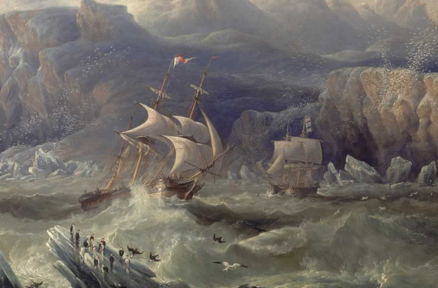
1872–1876 – HMS Challenger under Capt. George S. Nares, becomes the first steamship to cross the Antarctic Circle and reopened the study of oceanography in the region after a 30-year gap.
Between 1892–1893 and 1893-94, Carl Anton Larsen led the first and second Norwegian expeditions to Antarctica aboard the ship Jason. Besides having the Larsen Ice Shelf named after him he was also the first person to ski in Antarctica.
The 1892–1893 Dundee Whaling Expedition’s fleet of four ships discovered Dundee Island (63°30′S 055°55′W) while searching for whales in the southern ocean.
Sailing in the ship Antarctica between 1893–1895, Henryk Bull, Carstens Borchgrevink and Alexander von Tunzelmann set foot on Antarctica at Cape Adare and this is believed to be the first footprints on the Antarctic mainland, though they each disputed who was first. However, John Davis or Mercator Cooper may have a better claim of being the first.
Various explorers, such as Biscoe, Balleny, Charles Wilkes, Dumont D’Urville and James Clark Ross, would go on to expand our knowledge of the southern regions . Although their efforts were impressive were only able to discover islands and coastlines without setting foot on the continent.
After James Clark Ross reached McMurdo Sound in 1841 and named the volcanoes Erebus and Terror (after his two ships), southern exploration fell again into the doldrums.
Dr. John Murray gave a lecture to the Royal Geographical Society in London, in 1893 entitled “The Renewal of Antarctic Exploration”, in which he encouraged research into the Antarctic to “resolve the outstanding geographical questions still posed in the south”. This speech along with a general resurgence of interest in Antarctica by Geographical Societies would lead to the Heroic Age of Antarctic Exploration